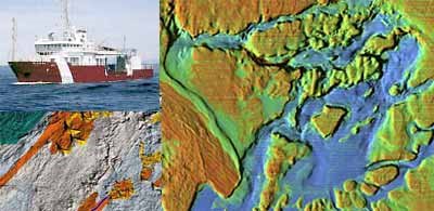
Underwater Mapping of the Oregon Coast

Interesting proposal from Oregon State university and other state agencies to do an intensive mapping effort of the territorial seafloor off the Oregon coast. They want to use multi-beam sonar to map it and replace the outdated depth charts.
They should be doing more of this kind of thing.
Photo Courtesy Gulf of Maine
Oregon Coast mapping News and Communication Services at Oregon State University


No comments:
Post a Comment